Friday, 30 May 2014

To the Tropic of Capricorn - Meekatharra to Newman

30th May 2014

Big drive north today and into the tropics.  The road was very monotonous with hundreds of kilometres between roadhouses.  The ground was the most barren we have seen in places, possibly due to overgrazing. Generally the desert is quite green with a thick cover of spinifex grass dotted with mulga trees.

Desert in Carnarvon Range region
As there is mining all the way along the Great Northern Highway we encountered several wide vehicles.  These are the ones you get off the road for!

This vehicle took up the entire highway
Newman is a BHP mining town, but not a bad size, so all services.  We are topped up with water, batteries are topped and everything charged ready for the next week in Karijini National Park where there are no services and the blog won't be updated for about 6 days.

Crossing the line

Thursday, 29 May 2014

Heading north again - Sandstone to Meekatharra

29th May 2014

Arrived in Meekatharra early afternoon having travelled via Mt Magnet and Cue.   We were fortunate enough to see 2 eagles and a goshawk at close range along the way.  This is the first time we have seen any birds of prey on this trip.

Bank of New South Wales building, Cue

Bandstand at Cue
We stopped for a quick break in Mt Magnet and a longer break in Cue for lunch.  Cue had high hopes for itself in the early 1900's, with grand buildings and a bandstand.  They styled themselves 'Queen town of the Murchison', which is the surrounding region.


As usual, all the 3 of the places we have been through today have been built on mining and pastoral activities, date to the late 19th century and are now in decline.


Seems Cue has the best water for miles around. We parked the caravan next to a public tap whilst I made lunch and there was quite a queue in Cue on the other side of the tap for the water.  People who have been camping 'outback' were coming in to fill up their water containers.


Queen of the Murchison Hotel

A lot of the pastoral leases in this area expire next year so it should be interesting what terms they may be renewed under. Grazing sheep and cattle does no good to the environment.  However neither do the herds of feral goats we have seen or the mining activities.

Meekatharra is disappointing, fairly scruffy and probably the worst campsite we have encountered so far.  It's the only one in town though and caters mostly to contract miners.

Wednesday, 28 May 2014

Drizzly day in Sandstone

28th May 2014

Fine drizzle, more of a mist really until about 1:30pm when it fined up with a clear blue sky.  Cold though, probably the coldest day we have had since leaving Sydney.

'London Bridge' rock formation


local resident red kangaroo
We followed some back country roads to find the old Sandstone mine, abandoned in 1982, and some spectacular rock formations, known as breakaways.  The rocks are basalt and formed much earlier than the surrounding sandstone rocks.  As the soft sandstone wears away the harder basalt is left standing above the plain, sometimes in spectacular formations such as this hole in the rock known as 'London Bridge'.  Eventually the formation will collapse, but fortunately not whilst we were there.

Abandoned buildings at Sandstone mine site
The mine site is pitted with old mine shafts, so quite dangerous. We didn't have a torch but they seemed to drop hundreds of metres into the ground.  We also came across an old government well built in the early 1900's.  These wells were built all over the arid interior of WA and were used to water livestock, horses, camels and people on the major transport and stock routes through the interior.  Water is never that far under the ground.

Contradiction well circa 1900

Tuesday, 27 May 2014

Into breakaway country - Leinster to Sandstone

27th May 2014

Just a short drive today to Sandstone, yet another little town which was originally built on gold.  The Sandstone residents were smart enough in the late 1920's to see that supporting the sheep farming industry was a smarter way to go so they survived unlike dozens of other ghost towns around here.  Now they are just hanging in and down to to about 120 residents in the entire Shire, which covers a vast area.

Spacious campground at Sandstone

There is an excellent campsite, with power and water, run by the Shire council and this undoubtedly encourages travellers to stay in the area a day or two longer.  The campsite has plenty of red dirt but there are a couple of areas of verdant lawn and flowering plants, which are watered twice a day.


We had a look at the old Catholic church.  This was restored in 1995, renamed Black Range chapel and made non denominational.  There are lovely [modern] stained glass windows and original pressed metal walls and ceilings.

St Athanasius 1908 [now Black Range Chapel]
Chapel interior


We had a wander into the back streets, now devoid of any buildings and found the golf course.  The tee off area and 'greens' are red dust mixed with oil to make a firmer surface which is less likely to blow away.  The fairways are just red dust and all around is as flat as can be!  The 'green' in the photograph was conveniently situated at the end of the airstrip runway so presumably if the the Flying Doctor arrives you have to get out of the way.

'Green' at the end of the airstrip


Monday, 26 May 2014

Following the goldfields, the Hoover connection - Kalgoorlie to Leinster

26th May 2014

Today we traveled north via Menzies to Leonora then on to Leinster.

Menzies was another gold rush town but sadly all that remains are a few grand public buildings and a couple of hotels.  We just had a brief stop there.

We decided to make a small detour just south of Leonora to Gwalia and were very pleased we did as it was fascinating.  This was a real ghost town.

The 'Sons of Gwalia' gold reef was discovered in 1896 and, as was usual with the gold rush, people hurried to the scene hoping to make a fortune.  A London based investment company sent a young 23 year old American mining engineer, Herbert Hoover, to evaluate the prospects.  He immediately set to work making changes to make the shaft mining more efficient.  In part he did this by importing Italian miners to Australia because they worked harder than the locals and complained less.  He then set about designing and building a mine Managers Residence, a Mine Office and an Assay Office all of which are in good condition and now open to the public.  This of course was the same Herbert Hoover who became the 31st president of the USA.  Remarkably he only stayed in the mine managers position for about 7 months before being sent to China but he left a lasting legacy and did return to stay in the house which was completed after he left.

Hoover house 1898
By contrast, the miners cottages were made of a timber framework covered in corrugated iron with a hessian lining.  Many had dirt floors and no kind of plumbing.  Further buildings were erected by the miners from whatever materials they could lay hands on.  Miners continued to live in these appalling conditions until 1963 when the mine closed. There followed a mass exodus to other mining towns on the goldfields.  Many of these original buildings, in various stages of restoration, remain to provide the most poignant reminder of the past we have yet seen in these gold rush towns.

Miners cottage
More upmarket miners cottage
 The mine was re-opened as open pit in recent years with the modern miners living in nearby Leonora.  The pit is huge, about half the size of the super pit at Kalgoorlie and the mine buildings and Hoover House are now perched right on the edge of the yawning chasm,  All significant constructions were relocated before the open pit mining commenced, including the timber headframe, the only one of it's type to survive in Australia.

Headframe 1899

We had such a great time exploring that we did not leave until 3:30 and decided to drive the 135 kilometres to Leinster for the night.  This meant driving into the setting sun which was challenging - dusk is exactly the time of day when kangaroos suddenly leap onto the road but fortunately we saw none.  In fact the road was so isolated we didn't see another vehicle for about 80kms.  We managed to get into camp just before sunset.  Leinster is a mining town too, however this is a much more recent one and the metal being mined is nickel, not gold.

Sunday, 25 May 2014

Another gold rush town - Coolgardie

25th May 2014

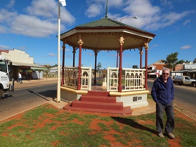
Gold was found at Coolgardie in 1892 and the population went from zero to 15,000 in just a few years.  Confidence was high so many substantial fine buildings were erected between 1893 and 1900.  Coolgardie had high hopes for itself, including the belief they should be the state capital instead of Perth.  By the late 1890's it was clear the goldfield at Kalgoorlie, only 35km away, was richer and many miners packed up their possessions and went there instead.

Coolgardie's growth slowed and the mining eventually ceased in 1963.  It is now lost in a time warp, not a ghost town exactly but not much going on either.  Fortunately many of the fine buildings remain.  They are built from a combination of locally fired bricks made with rock dust left over from the crushing process and a beautiful pink sandstone quarried from an area to the north.  Nowadays there are many active gold mines in the area due to improved recovery techniques, but the employees choose mostly to live in Kalgoorlie.

Wardens Court Building 1898
Water was always a problem in this arid area.  The few natural waterholes were soon inadequate, bore water is very saline and the annual rainfall is very low.  Water was carted great distances and also condensed  from bore water using wood fired boilers.  This soon depleted all the trees for miles around.  Shortly before the life saving 'golden pipeline' was installed from the hills east of Perth in 1903 water was selling for 5 shillings a gallon, which by weight was higher than the price of gold at that time.  The same pipeline carried water to Kalgoorlie and allowed that town to flourish.

A feature of all these outback towns is the enormously wide streets.  In the arid areas it is because they had to be wide enough for a camel train to turn around. Camels were introduced from Afghanistan and were the major form of transport in desert areas until the arrival of railways.  In the eastern states the roads are similarly wide, in that case it was a bullock team to be turned around.

The railway arrived in 1896 but has long since been re routed to the north.  We found an old steam train complete with 1st and 2nd class carriages and a goods van on the platform.  The goods van included an insulated area with meat hooks in the ceiling for keeping the perishables cool on the journey from Perth.  It would be great if the money and enthusiasm of volunteers could be found to restore it all one day.
  
Coolgardie Railway station 1896
Most of the miners lived in whatever they could find, usually a tent to start with but as money was made and materials could be found they added a tin roof and tin walls.  Boiling in summer and freezing in winter.  By contrast the Warden [also Magistrate] lived in a well designed house on one of the few hills around.  The house, circa 1895, was designed and built as a government contract by the Bunnings brothers [yes, of Bunnings Warehouse fame].  They were 18 and 19 years old at the time.  Now in the hands of the National Trust, the house is superbly designed with 45cm thick outside walls and 30cm thick internal walls constructed from the local pink sandstone.  These combined with wraparound verandahs, louvred breezeways and a roof lantern served to keep the house beautifully cool in the summer and would have provided some insulation in the winter.

Warden Finnerty's Residence
 We arrived back in Kalgoorlie mid afternoon expecting to do a top up grocery shop before heading into the sparsely populated north.  However, everything, including Coles and Woolworths supermarkets closes on Sunday!  This place really is a frontier town.  We will have to go tomorrow morning before setting off, tomorrow is a relatively short drive anyway.

Saturday, 24 May 2014

The Super Pit - Kalgoorlie

24th May 2014

This morning we did a mine tour which goes down into the top of the super pit.  The commentary explains the process of blasting the rock, crushing into ever smaller pieces until at the end there is a slurry containing the gold, which is then chemically removed.  A huge amount of rock has to be processed to find a very small amount of gold but despite this 22 tonnes a year are being produced.  The mine provides employment for some 3,800 people.

Looking into the big pit with rock loaded haul trucks

The current lease expires in 2021 and if it is not profitable to continue at that time it will be closed but not filled in.  There is more gold locked in the rocks which current technology is unable to release so the open pit will remain for future possibilities.    Although the mine is run by an Australian company, Kalgoorlie Consolidated  Gold Mines, the leaseholders who are 50% Canadian and 50% American own the operation.

Huge haul truck dwarfs regular vehicle

I wonder what will happen to the town when the mine closes as not only is it a direct employer but many ancillary services rely on the mine and it's workers for their business.

Friday, 23 May 2014

Exploring the mining town - around Kalgoorlie-Boulder

23rd May 2014

John had a well earned rest this morning whilst I went to the goldfields museum which was very well presented.  There was information about the discovery of the richest gold seam in the world and the hardships of the early miners as well as a social history and a display of unprocessed gold nuggets and gold bearing rocks which are worth $4,000,000 according to the lady providing information.

Unprocessed gold nugget

This museum lady, who is from Liverpool in England and has been here for 20 months, and a hairdresser who cut John's hair who is from Yorkshire and has been here 6 months, are both with their husbands who have engineering skills to work in the mine. Seems Kalgoorlie is a good place for would be migrants to work until they have lived here for 4 years and can apply for citizenship.

The museum is built around an old hotel, the British Arms, which is the narrowest in Australia at about 5 metres and said to be haunted.  Several other old buildings have been moved to the site and re erected including a tin miners cottage and a mobile police station.  Seems the police station, in a converted rail wagon was shunted from one goldfield town to another as the need arose for law and order!

Mobile police station - early 20th century
Bumpy ride on this timber bicycle
The men seized by gold fever went to great lengths to get to the mine sites, the museum even has a home made bicycle made from bits of timber and scrap metal!

In the afternoon we drove to have a look at the Super Pit, which is the largest open cut mine in the world - a huge hole in the ground which is currently some 3.5kms in length and over 600 metres deep and growing.    The mine was formed in the 1980's by buying up all the smaller leases which were using conventional shaft and tunnel mining.  We will find out more tomorrow when we do a mine tour.
Scoop from a mine digger

We also went into the Metropole Hotel to check out the mine shaft under the floor, which these days is covered with a glass panel for viewing.  The hotel was built directly over the shaft and legend has it that the miners would ascend the ladders with their diggings and put them on the bar for payment.

Thursday, 22 May 2014

Traffic lights again - Balladonia to Kalgoorlie

22nd May 2014

The last of the long tedious drives today -at least for a few days.  The morning started very misty and damp, but no rain and we were away by 7:20am.

The endless road between Balladonia and Norseman

We arrived in Kalgoorlie - Boulder at lunch time, set up in a very nice little caravan park and then went to do a big shop in Coles!  This was the first opportunity we have had since Port Augusta to buy groceries and fresh fruit and veg, which cannot be taken across the state border.  We also bought some 25 litre water containers to supplement the caravan tanks.  No water was available to fill the tanks on the Nullarbor between Ceduna and Norseman.  We are concerned we will run out when travelling up to the Pilbarra as water is in scarce supply in most of the state and not necessarily available in the camp sites.  We will also encounter shortages down the west coast until we get to Geraldton.  No problem in Kalgoorlie though, their water is piped all the way from Perth and has been for the last 100 years.

Kalgoorie seems to be in a bit of a time warp with a wide main street and strip shops, no malls that we could find.  Grand buildings though, built in the early 20th century on the riches from the goldfields.  We will explore tomorrow after catching up with the laundry, still the same chores as at home.

Exchange Hotel, Kalgoorlie

Wednesday, 21 May 2014

To the Western edge of the plain - Cocklebiddy to Balladonia

21st May 2014

This morning we drove down to the Eyre Bird Observatory on the coast [without the caravan].  The road in is 30kms, the first 20 of which was a reasonable unsealed road which then went down a steep escarpment and over soft sand dunes to the sea.  John did a great job of handling the vehicle in the soft sand.

The area is named after John Eyre the explorer who was finding a land route from eastern to western Australia.

The sand road to Eyre

Eyre sand dunes
The observatory is based in the old Eyre telegraph station which was built in 1897 replacing older buildings. The telegraph line from Adelaide to Perth ran right along the coast at this point and many of the posts and wires are still in place.  There are many birds around the area including honeyeaters, finches, pardalotes and swallows.  The air was full of their song but they flit around so fast it was hard to get any photographs.  

Eyre Bird Observatory
The area is incredibly beautiful and tranquil and we enjoyed a walk through the dunes to the beach.

Beach at Eyre
After this it was back to the long journey west.  We were soon onto the longest stretch of straight road in Australia - 145.6 kms without a bend and scarcely an undulation.   Spending the night in Balladonia which marks the western edge of the plain.

The longest straight road in Australia


Tuesday, 20 May 2014

Across the plain - Nullarbor roadhouse SA to Cocklebiddy roadhouse WA

20th May 2014

A big drive today stopping at most of the fabulous lookouts on the way.  The road is only about 500 metres from the cliff edge for a distance of about 100km and there are a number of designated lookout spots and an even greater number of rough tracks to the sheer cliff edge which in places drops about 80 metres to the pounding southern ocean below. It's a bit like the Great Ocean Road but without the tourists, just a few grey nomads.
Eastern view of Bunda cliffs on Nullarbor Plain
Western view of Bunda cliffs on Nullarbor Plain
We didn't see any animals today but did see a suprising diversity of plants which struggle to survive on the harsh limestone surface which holds no water.  As soon as there is any rain the flowering plants burst into activity and I counted 6 different wildflowers at one lookout so there must have been some rain recently.  The saltbush survives because it is able to extract moisture from the air through it's leaves.

Big roo at SA/ WA state border

At the state border there was an inevitable 'big thing'.  This time a giant roo accompanied by a signpost to various places both nationally and internationally.  Sydney over 2,000kms away as the crow flies but we have travelled over 3,500 kms.

Border Crossing

As we approached Madura the land became more hilly and larger amounts of trees were noticeable. At our overnight stop we are about 30kms from the ocean and early tomorrow we plan to visit a bird sanctuary on the coast via a dirt road.


Monday, 19 May 2014

To the eastern edge of the Nullarbor - Ceduna to Nullarbor roadhouse

19th May 2014

Today we reached the eastern edge of the nullarbor plain.  It is true, the plain is virtually treeless and has a covering of saltbush shrubs.  On the way we took note of the warning sign re camels, wombats and kangaroos, but saw none.

Watch out for these animals

The nullarbor plain is the biggest limestone plateau in the world covering about 250,000 square km and is up to 300 metres thick.  The plateau was formed as a coral reef on an ancient seafloor which was then uplifted. The plateau extends some distance out to sea but is being constantly eroded by the southern ocean forming sheer cliffs up to 60 metres high in places.  On the eastern side of the bight the cliffs have been covered by sand dunes which are highly mobile and are moving inland at a rate of 11 metres a year.

Head of Bight

We are at the eastern edge of the Nullarbor National park which extends west to the WA border and north about 20 km.  This area is protected and recovering from former sheep grazing leases.  There is a suprisingly diverse range of animals in this harsh environment but all we saw today was a 'slow lizard', similar to a blue tongue and about 40cm in length and a lovely little orange lizard which I haven't been able to identify yet.

We went to the lookout at the Head of Bight as this is an area renowned for southern right whales which come to the sheltered area to calve and mate before returning to Antarctic waters.  They do this between May and October so we are a bit early in the season.  We only saw one whale though there had been three visible earlier in the day.  The views however were absolutely spectacular.
At Nullarbor roadhouse refuelling next to the planes


The roadhouse is the only sign of life for over 150km in either direction so is quite busy though there only seems to be about a dozen caravans  tonight.  It all happens here, fuel for cars, trucks and planes, and a chance to stock up on scarce water supplies and stay the night with power from the generator.

A vehicle that didn't make the crossing


Sunday, 18 May 2014

The endless road - Kimba to Ceduna

18th May 2014

An early start to hit the Eyre Highway again.  The land is gently undulating with a few mountain ranges off to the north.  A suprising amount of the land is under cultivation, cropping wheat and there are some sheep stations too.  We actually had a shower of rain for the first half an hour of the journey.

Due to such a great start we arrived in Ceduna at lunchtime to find the place closed! [it is Sunday].  I made some lunch and we set up at a lovely spot above the beach to admire the view.  The temperature was lovely and warm at 27 degrees, but it cooled off fairly rapidly at sunset.

Ceduna
We enjoyed a Facetime link up with Simone and family.  Katherine was very interactive and recited some new words for us and Amelie told us about how she is now riding her bike without falling off.  Yesterday we had a link up with Nicole and family which Joel found incredibly exciting.  Nathan told us about winning his school 'cross country' race [400 metres].  Lovely to see and talk to them all, though the internet link was a bit disappointing.

Saturday, 17 May 2014

Across the Eyre Peninsula - Burra to Kimba

17th May 2014

Big drive today.  From Burra we drove via Crystal Brook to the Spencer Gulf just south of Port Pirie then on through Port Augusta and onto the Eyre Highway arriving at Kimba about 2:30pm.  Since Port Augusta is the last biggish town we will see until Kalgoorlie we stocked up at the local Coles.  We did not get too much fresh fruit and veg though as there seems to be a quarantine checkpoint at Ceduna as well as at the WA border.

Grain silos with wagons being loaded at Kimba

Kimba is a tiny place with a few claims to fame.

Firstly, it is the main storage area for wheat grown on the surrounding countryside which is stored in huge silos then loaded on to trains which take it to the coast. Apparently the biggest such facility in SA.  Growing grain in this area must be very marginal as the annual rainfall is only about 340ml.


The second claim is that the town is halfway across Australia!  Take note of the sign.
Halfway across Australia

Thirdly they have a Big Galah!  I guess Australians are obsessed with 'big things' so it was smart for them to have one of their own.
The Big Galah - Kimba

Having exhausted all points of interest in the town we returned to the van to relax for the rest of the day.  We are on a drive through site so remained hitched up and ready to get away early tomorrow.

John relaxing in our van (with fly swatter handy)

Friday, 16 May 2014

Exploring the Burra Mine site

16th May 2014

The mining company advertised in Britain for workers to emigrate to SA.  They not only wanted miners, but also stone masons, engineers, blacksmiths and other skilled trades.  A man and his wife received passage at no cost, but they had to pay for children between the ages of 1 and 15 years.  The mining company was also after 'young ladies over 15 years of good character' who could travel free if accompanied by a relative.

Open cast mine pit as it was left in 1981
Boys started work at 8 years old and were down the mine by age 12.  The men and boys worked in dangerous and dirty conditions with only a candle attached to their tin hat for light. Payment was made according to the quantity and quality of the copper ore they extracted.

Water flooding the mine was a major problem and many pumps were installed to remove it.  These were all made in Cornwall and shipped to Adelaide.  The huge equipment was then dragged by bullock teams on the 100 mile journey to Burra.  Morphett's engine house was one of the installations.

Morphett's Enginehouse 1858
Ore dressing Tower
The ore was crushed, graded and assayed at the mine site and then taken to the valley for smelting.  All the resulting copper ingots were shipped to England, none of it was ever used in Australia.